i-InfoTerre: BRGM's Geoscience Data Viewer for Android
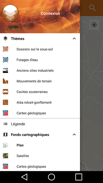
i-InfoTerre is a free Android application developed by BRGM that offers online cartographic access to various thematic layers of geoscience data. These layers include files on the basement, water boreholes, old industrial sites, ground movements, underground cavities, and random shrinkage-swelling. The application also provides access to several base maps, including orthophotos, plan, and geological maps.
Users can position themselves on the map manually using pan and zoom multitouch gestures, or they can use the GPS to locate themselves automatically. Alternatively, they can use the municipal directory to find a specific location.
It is important to note that the information accessible through i-InfoTerre corresponds to the state of scientific knowledge at the time of publication and is regularly updated. However, data that may be subject to dissemination restrictions for legal or environmental reasons are not available through the app. Users with questions about the application can submit them via the BRGM assistance site.